


I drove the Black Forest from Baden-Baden to Freiburg the slow way, trading the fast A5 autobahn for ridge roads, lake detours and clock towns. This was not the theoretical “perfect route” you see on maps, but an actual three-day drive in a compact rental car, with real parking machines, cramped hairpins, rain on the windshield and the occasional wrong turn. Here is exactly how it felt to pick up the car in Baden-Baden, follow the B500 Black Forest High Road toward Freudenstadt, loop through Triberg and Gengenbach, skim past Titisee and finally roll into Freiburg, with a candid look at which scenic detours were worth it and which famous stops I would skip next time.
Picking up the rental car in Baden-Baden
I started in Baden-Baden after arriving by train at Baden-Baden station and continuing by local train into the town center. I picked up a compact automatic from a major rental agency with an office near the Kurhaus, about a ten-minute walk from the colonnades and the Trinkhalle. The car was a recent Volkswagen Golf class hatchback, which proved to be almost ideal for the Black Forest: narrow enough for tight village streets and underground garages, but still stable on fast federal roads like the B500.
The rental process itself mirrored what most travelers can expect in 2026 in Germany: passport and license checked at the counter, credit-card deposit held, and a quick explanation that the car used AdBlue and needed regular unleaded fuel (Super E5 or E10). I added basic collision damage coverage but skipped extras like GPS, relying on offline maps on my phone. The staff reminded me that in the Black Forest region, mobile coverage drops in some valleys, which turned out to be true on the smaller roads between Triberg and Gengenbach.
Parking in Baden-Baden before departure was my first real logistics test. The easiest solution was an underground city garage close to the Kurhaus. Entrances in Baden-Baden’s center can feel tight by North American standards, with narrow ramps and tight turning radii, but the Golf slipped in comfortably. Ticket machines accepted cards and coins, and I paid just under 10 euros for a few hours while grabbing lunch and stocking up on snacks and water for the drive. Keeping a stash of small coins already proved useful, since a lot of smaller town parking later on still worked with basic machines.
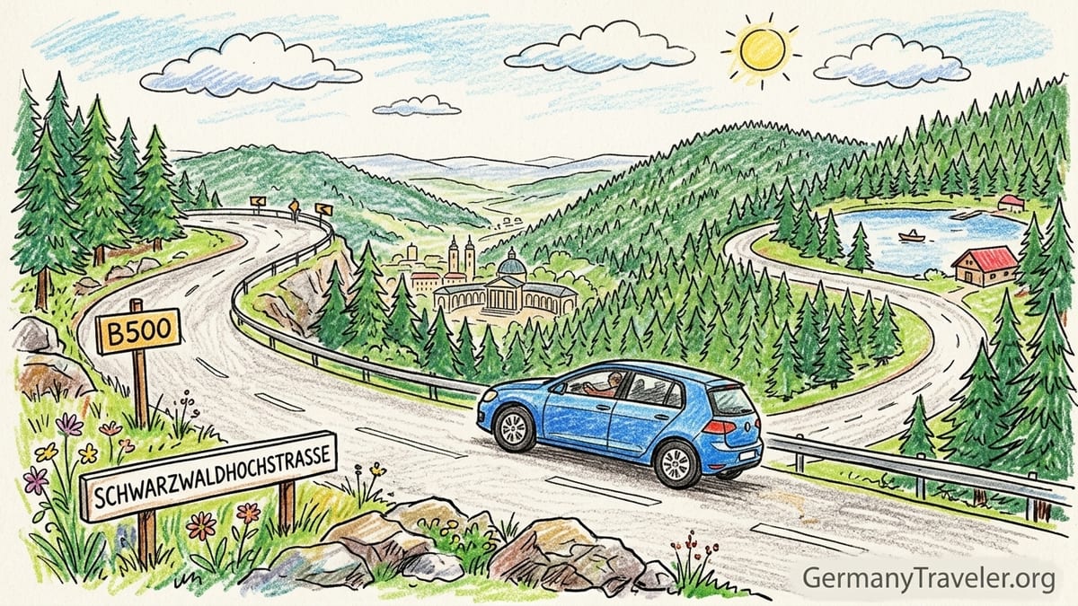
Leaving the city, I followed signs toward the B500 and Schwarzwaldhochstrasse. Traffic circles link the spa quarter to the climb out of town, and it takes only a few minutes before the urban streets give way to forested slopes. Here the road begins to do what it will do for much of the day: sweep upward in broad, well-engineered curves, with the forest thick on both sides and occasional gaps opening toward the Rhine plain.
Climbing onto the Black Forest High Road (B500)
The Schwarzwaldhochstrasse, or Black Forest High Road, is the scenic heart of this route between Baden-Baden and Freudenstadt. It runs for roughly 60 kilometers along the ridge of the northern Black Forest and stays mostly between 800 and 1,000 meters of elevation. Even before I had driven many kilometers, it became obvious why this stretch has been promoted as Germany’s oldest scenic road for decades.
From Baden-Baden, the B500 narrows from urban multi-lane segments to a standard two-lane federal road with a center line and shoulders. On my drive in late spring, the pavement was in good condition, with only short patches of roadworks. The curves are frequent but flowing, designed more for long-radius bends than hairpins, which makes it comfortable even for drivers not used to mountain roads. Overtaking can be tricky when the road is busy, especially behind campervans, but there are a few designated passing lanes on steeper sections.
Several viewpoints interrupt the forest. One of the earliest memorable pauses was at a lay-by where the trees parted to reveal the broad Rhine valley and, on a clear day, the distant Vosges in France. In my case, haze softened the horizon, but the effect was still impressive. Simple gravel pull-offs with room for half a dozen cars are common, and they fill quickly on sunny weekends. I found it easiest to slow down slightly whenever a gap in the guardrail suggested a viewpoint, then pull in if there was safe space.
The most obviously commercial stop along this ridge is Mummelsee, a small mountain lake with a large car park, hotel, restaurant and souvenir shop. I pulled in out of curiosity and found the parking area almost as large as the lake itself, lined with buses, motorcycles and cars. Paths circle the water in under half an hour. It is easy to stretch your legs, but the atmosphere felt more like a highway rest area than a tranquil alpine lake. Next time I would probably skip Mummelsee altogether and spend those 30 minutes at a quieter lay-by or on a short trail like the Lotharpfad near Ruhestein, which feels closer to the landscape the Black Forest is famous for.
Weather on the ridge and how it affects the drive
I drove the Black Forest High Road in late May, which is shoulder season for the region. Down in Baden-Baden, temperatures hovered around 20 degrees Celsius with light cloud and dry roads. Climbing onto the ridge, the temperature display in the car dropped by a couple of degrees, and I drove through stretches of drifting mist even on an otherwise bright day. Drivers should be ready for this contrast: the B500 crosses high, exposed terrain where weather changes faster than in the valleys.
At several points, visibility dropped to the point where I slowed well below the posted limit of 80 kilometers per hour. Some curves are bordered by dense fir forest that darkens the road even in daylight, and in the mist it feels like driving inside a tunnel of trees. On a wet or foggy day, headlights and patient braking are more important than trying to maintain a constant average speed. I allowed a little over two hours for the approximately 60 kilometers between Baden-Baden and Freudenstadt, including a couple of short stops, and that felt reasonable without rushing.
In winter or early spring, snow and ice are common on this ridge road, and local guidance warns that access can be restricted when car parks reach capacity or in severe conditions. Even outside winter, night driving on the B500 is not ideal for visitors, in part because animal crossings and unlit curves demand more concentration. On my spring drive, I planned each segment to arrive at the next town before dusk and found that it reduced stress significantly, especially when looking for unfamiliar parking garages.
One of the less obvious weather-related factors was wind. On the open stretches near the highest points of the route, crosswinds pushed lightly at the car. It never felt dangerous in a modern compact, but I could imagine larger side-profile vehicles such as campervans moving around more. Anyone renting such a vehicle for this route should take advantage of the many lay-bys to stop if gusts become uncomfortable and wait for conditions to ease.
Freudenstadt and fuel stops along the way
Freudenstadt marks the southern end of the classic Black Forest High Road. The town sits at a crossroads of several federal roads, with the B500 joining the B28 near the famous market square, often described as one of the largest in Germany. Arriving from the ridge, the descent into Freudenstadt feels like reentering ordinary traffic after a mountain drive, with roundabouts, crosswalks and local speed limits.
I parked in an underground garage just off the central square, accessible via clearly marked signs from the main approach roads. The entrance ramp was steep but manageable, with sufficient width even for larger vehicles. Inside, spaces were standard-sized for German garages, meaning that wider SUVs would need to take a little care but would still fit. Payment machines accepted contactless cards. I paid for a couple of hours so I could walk across the arcaded edges of the square and grab coffee before continuing south.
Freudenstadt is also a practical place for fuel. There are filling stations on the outskirts of town with easy access from the federal roads, typically offering both E10 and E5 unleaded plus diesel. Prices during my trip were broadly in line with the German average for spring 2026, with minor differences from one brand to another. For planning purposes, it is wise to refill here or in Baden-Baden rather than relying on smaller stations deeper in the forest, since opening hours can be shorter away from main roads.
Driving time from Baden-Baden to Freudenstadt via the B500, with two short viewpoint stops and one longer pause at Mummelsee, came to about two and a half hours door to door. Without stops and in clear weather, you could cover the distance in roughly ninety minutes, but factoring in lay-bys, photos and slower sections makes the longer estimate more realistic. That slower pace is part of the appeal of this route and helps keep fatigue at bay for the rest of the trip deeper into the central and southern Black Forest.
South from Freudenstadt to Triberg and why I would still go
From Freudenstadt, I headed toward Triberg, one of the best-known tourist stops in the Black Forest. The exact route options vary, but my drive combined stretches of federal roads with smaller regional roads. The character of the drive changed noticeably compared with the B500 ridge road. Instead of staying high, the route alternated between forested hillsides and open valley floors, with more villages, tighter bends and frequent speed-limit changes.
The road surface was mostly good, though some narrower sections in forested corridors felt distinctly more confined, with trees close to the edge of the carriageway and limited visibility around bends. Passing opportunities were fewer than on the B500, and I found myself settling into the speed of local traffic. Average speed dropped, and the roughly 60 to 70 kilometers between Freudenstadt and Triberg took close to an hour and a half, including one short stop at a roadside bakery for coffee and a sandwich.
Triberg itself announces its presence well before the town center, with signs highlighting “Germany’s highest waterfalls” and numerous roadside shops selling cuckoo clocks. Traffic funnels into a relatively short central strip where the main car parks for the waterfalls and town are located. I parked in a signed lot within walking distance of the waterfall entrance, using a ticket machine that accepted both coins and cards. Spaces filled quickly by late morning, and maneuvering in and out required patience as visitors searched for spots.
The waterfalls are genuinely pleasant, a steep series of cascades accessed by a network of walking paths and viewpoints. However, the combination of entry fee, souvenir stands and dense crowds meant the experience felt more commercial than atmospheric. I was glad I saw Triberg once, because it really is part of the classic Black Forest picture many visitors imagine, but on a future trip I might choose a quieter gorge or waterfall hike instead and spend more time on the surrounding roads and villages, which capture the region’s mood just as well without the same level of tour-bus traffic.
Detour to Gengenbach and how parking really works there
After leaving Triberg, I steered northwest toward the Kinzig valley and Gengenbach, one of the most photogenic half-timbered towns in the Black Forest region. The drive followed a mix of regional and federal roads, including stretches of the B33 corridor, with broader river-valley sections and more gentle curves than the road between Freudenstadt and Triberg. On this leg, the scenery shifted from dense conifer forest to a mix of wooded slopes, meadows and river farmland, punctuated by industrial sites and small towns.
Compared with Triberg, Gengenbach felt less overtly touristy despite being a known stop on timber-frame routes. Approaching from the east, signage directed drivers to several public car parks around the edge of the historic core. I chose the large Kinzigtalhalle parking area, which the town promotes as a free day-parking option for visitors. From there, it took less than ten minutes on foot to reach the old town gate and central square, walking along quiet streets with clear pedestrian crossings.
The absence of a parking fee at that lot made Gengenbach one of the easier and more relaxed stops on the drive. Other car parks closer to the center used ticket machines and time limits, and some street parking zones were reserved for residents, so it helped to check the local map and signage posted at the Kinzigtalhalle lot. For visitors driving a rented vehicle and unsure about local rules, parking a short walk away at a clearly designated facility is often less stressful than circling narrow medieval streets in search of a closer space.
In terms of scenery, the Gengenbach detour absolutely justified its extra driving time. The town’s half-timbered houses and small riverfront are exactly the kind of setting many travelers hope to find in the Black Forest, and the roads in and out, while not as dramatically rugged as the B500, offer a satisfying combination of valley landscapes and gentle slopes. If time were tight, I would skip some of the more overtly commercial stops and keep Gengenbach on the list.
Titisee and the question of whether the lake detour is worth it
From the Kinzig valley, I cut southeast toward the highlands around Titisee, crossing back into more forested territory and climbing steadily. The roads on this segment varied between modern federal routes and smaller connectors that threaded through villages and woodland. As I approached Titisee, the traffic density increased, with tour buses, coaches and private cars all aiming for the lakeshore.
Parking at Titisee was more complicated than in Gengenbach. The main lakeside promenade is bordered by several large pay-and-display car parks, some operated by the municipality and others associated with hotels or attractions. I chose a municipal lot a short walk from the water, paying for two hours at a machine that accepted coins and card. Even on a weekday outside peak season, spaces near the lake filled quickly, and arriving earlier in the day would have made things easier.
Titisee itself is scenic, with clear water framed by forested hills and a pedestrian promenade lined with cafes and shops. Boat rentals and short cruises were operating during my visit, and families filled the paths and pebble shore. As a visual introduction to the southern Black Forest lakes, it works well, but the atmosphere felt closer to a resort town than a wilderness escape. For travelers who enjoy strolling, ice cream and a quick boat ride, the detour is a good fit. For anyone prioritizing quieter roads and less commercial landscapes, it may feel less essential than the B500 ridge or smaller side valleys.
On balance, I am glad I stopped once at Titisee, but if time were limited on a future trip, I might trade the lake promenade for an extra hour exploring backroads between Triberg and Freiburg or an additional hike near the ridge roads south of Freiburg. The drive to and from Titisee added meaningful time to the day, and while the lake is pretty, it was not the highlight of the journey compared to the forested ridges and unexpected viewpoints elsewhere.
Final stretch into Freiburg and city parking
The last leg from Titisee to Freiburg followed the B31 corridor, a major east west route through the southern Black Forest. After the winding roads of the previous days, the B31 felt fast and relatively direct, with long tunnels, multi-lane segments and higher posted speeds in places. Traffic included trucks and commuters as well as tourists, so the atmosphere was more like a regular arterial highway than a scenic byway, even though the surrounding hills and valleys remained attractive.
From Titisee to the outskirts of Freiburg took under an hour of steady driving in light traffic. Approaching the city, signage split traffic between the university area, central station and various districts. I had booked accommodation on the edge of the old town, and the hotel recommended a nearby public underground garage rather than attempting to park on narrow residential streets. Following the signs into the center, I entered a multi-level underground garage with ramped access and electronic boards showing available spaces.
Parking in central Freiburg is more expensive than in the smaller Black Forest towns, with hourly rates that reflect its status as a larger university city. Payment systems are modern and straightforward, using tickets, barrier arms and card-enabled machines. Street-level parking near the pedestrian zone is scarce and time limited, so using garages is usually the best option if you want to leave the car for an afternoon of walking through the Altstadt and visiting the cathedral square.
After several days on curving forest roads, walking around Freiburg felt like a release. The compact size of the historic center means you can cover most of the main streets, canals and squares on foot, and there is little reason to move the car until you are ready to depart the region. In hindsight, it worked well to end the route here and hand back the keys the following day, avoiding urban driving in larger cities and keeping the rental period focused on the days spent in the forest.
The roads and stops I would prioritize next time
Looking back on the entire drive from Baden-Baden to Freiburg, a clear hierarchy emerged between the roads and stops. The Black Forest High Road between Baden-Baden and Freudenstadt remains the single most rewarding continuous stretch of driving. Its combination of elevation, long curves, frequent viewpoints and solid surface quality would justify the trip on its own. If I had just one day in the region with a rental car, I would still choose that ridge route, even if it meant turning around in Freudenstadt and returning the same way.
Among the detours, Gengenbach stands out as a stop that justifies both time and distance. The ease of parking at the edge of town, the short walk into the historic core, and the pleasant mix of river and timber-frame architecture make it feel like the kind of place that rewards an unrushed lunch break or evening stroll. I would plan at least a half day there on a future visit, possibly staying overnight to see the old town after day trippers leave.
Triberg and Titisee, by contrast, fall into the category of stops I am pleased to have experienced once but would not necessarily repeat with limited time. The waterfalls at Triberg are atmospheric, but the surrounding commercial focus and crowded central car parks reduce some of the charm. Titisee’s lakeside promenade is undeniably pretty, yet the overall feel is more resort-oriented than uniquely Black Forest. Faced with a choice, I would devote those hours to exploring smaller valleys, hiking near less crowded viewpoints, or simply adding extra pauses on the B500 ridge itself.
Finally, the valley and connector roads between these major points, including those linking Freudenstadt to Triberg and Gengenbach to Titisee, contribute significantly to the sense of journey even if they lack headline status. They offer a more everyday view of the region: working villages, agricultural land, small industry and forest management. Next time, I would keep them in the route but choose specific hiking or picnic spots along the way, turning the drive into a sequence of shorter scenic hops rather than one long day behind the wheel.
The Takeaway
Driving from Baden-Baden to Freiburg through the Black Forest in a rental car turned out to be less about checking off famous sights and more about understanding how the region fits together. The B500 Black Forest High Road set the tone, with its high ridge views, wide curves and sudden glimpses of valleys far below. Towns like Freudenstadt and Gengenbach grounded the trip in daily life, offering parking, fuel and real streets to walk before climbing back into the trees.
From a practical standpoint, the drive demanded some planning but never felt intimidating. Roads were generally well maintained and clearly signed, rental agencies in Baden-Baden were accustomed to visitors heading for the Schwarzwald, and parking solutions existed at each major stop even if they required a short walk. Weather on the ridge could change quickly, and average speeds were lower than map estimates might suggest, but building generous time into the schedule made those variables manageable.
Most importantly, the route proved that not all “must see” stops are equal. The most commercialized sights added less to my own experience than quiet viewpoints, side-of-the-road bakeries and small car parks where I could simply stand and listen to the forest. On a return trip, I would prioritize the ridge roads, smaller towns and flexible pauses that created those moments, using cities like Freiburg mainly as comfortable bookends at either end of the journey.
FAQ
Q1. How long does it take to drive from Baden-Baden to Freiburg through the Black Forest?
Allow at least one long day or, preferably, two to three days if you plan to stop in Freudenstadt, Triberg, Gengenbach and Titisee along the way.
Q2. What kind of car is best for the Black Forest High Road?
A compact hatchback or small sedan is ideal, since it fits easily in town garages and handles the B500 curves without the bulk of a large SUV or campervan.
Q3. Is the B500 Black Forest High Road difficult or dangerous to drive?
In good weather it is a well-engineered ridge road with wide curves and solid barriers, more flowing than extreme, though caution is needed in fog, snow or heavy rain.
Q4. Where are the easiest places to park along this route?
Freudenstadt and Freiburg have signed garages near their centers, Triberg and Titisee use pay lots close to the sights, and Gengenbach offers a convenient free lot near the old town.
Q5. Do I need to prebook anything for this road trip?
You should reserve your rental car and accommodation in advance, especially in summer, but sightseeing along the route, including the B500 itself, generally does not require reservations.
Q6. Is fuel easy to find between Baden-Baden and Freiburg?
Yes, there are filling stations in and around Baden-Baden, Freudenstadt, the larger valleys and near Freiburg; it is simply wise to top up in the bigger towns.
Q7. When is the best time of year to drive this route?
Late spring, summer and early autumn offer the most reliable conditions, with long daylight hours and largely snow-free roads, though weekends can be busier.
Q8. Can I do this route in bad weather?
Rain and mist are common, especially on the ridge, and the drive remains possible, but you should reduce speed, use headlights and avoid tight schedules in poor visibility.
Q9. Are there road tolls on the B500 or between these towns?
There are no tolls on the B500 or the other main roads used for this route, and standard rental cars do not require any additional passes for this area.
Q10. Which stops would you skip if you had only one day for the drive?
With limited time, I would focus on the B500 ridge and a single town like Gengenbach or Freiburg, and consider skipping Titisee and Triberg to avoid backtracking and crowds.