


Franconian Switzerland, or Fränkische Schweiz, is one of Germany’s most compact outdoor playgrounds: a landscape of Jurassic limestone cliffs, deep valleys, forested hills and hilltop castles between Bamberg, Bayreuth and Nuremberg. Despite the name there are no Alpine peaks here. The “Switzerland” label, coined in the 19th century, refers instead to the area’s rugged scenic character, with rock towers and romantic valleys that reminded early travelers of Swiss mountain scenery on a gentler scale.
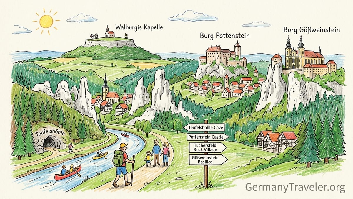
Understanding Franconian Switzerland’s Landscape
The core of Franconian Switzerland lies in the northern Franconian Jura, a plateau of Jurassic limestone carved by rivers like the Wiesent into steep-walled valleys. Over millions of years, water dissolved the limestone to form caves, sinkholes and bizarre rock pinnacles. When you stand on a lookout such as Walberla above Kirchehrenbach, you see not alpine summits but a rolling highland cut by green valleys, with white limestone crags, patchwork fields and scattered villages of half-timbered houses.
This geological history explains why the region is dotted with caves like Teufelshöhle near Pottenstein and Sophienhöhle at Burg Rabenstein. Beneath the beech and mixed forests lies a honeycomb of caverns decorated with dripstones. On the surface you find free-standing rock towers that climbers prize, as well as cliffs crowned by small castles such as Pottenstein and Gößweinstein. For visitors, the result is a destination where you can realistically combine short drives or bus rides with half-day hikes, a cave tour and a castle visit in a single day.
Because this is a low mountain and plateau region, the typical hiking elevation gains are in the range of 200 to 500 meters rather than the thousand-meter climbs of the Alps. Trails often start in valley villages like Muggendorf, Pottenstein or Tüchersfeld and climb onto the surrounding plateau along forest paths and rocky steps. Surfaces are usually a mixture of packed forest tracks, field paths and occasionally rough limestone underfoot near viewpoints, so sturdy footwear is important even on easier routes.
For planning, it is helpful to think of Franconian Switzerland not as one continuous ridge but as a mosaic of individual valleys and hills. The main activity clusters for most visitors are Pottenstein with its show cave and family attractions, Gößweinstein on a prominent plateau spur, the rock village of Tüchersfeld in the Püttlach valley, the Wiesent valley around Muggendorf and Streitberg, the Walberla / Ehrenbürg hill near Forchheim, and the Rabenstein area further east. Each can anchor a day of mixed outdoor activities without long transfers.
Pottenstein: Teufelshöhle, Castle and Family Attractions
Pottenstein is one of the classic bases in Franconian Switzerland, set in a narrow valley dominated by a rocky castle spur. Above the old town, Burg Pottenstein looks directly onto the cliffs, while just outside the village the entrance arch of Teufelshöhle (Devil’s Cave) opens in a forested slope. Around it, a cluster of family-oriented attractions, from a summer toboggan track to a small climbing and ropes area, means families can easily spend a full day here.
Teufelshöhle is the largest and best-known dripstone cave in Franconian Switzerland, with a guided tour that typically lasts around 45 to 60 minutes. Official information notes that visitors negotiate about 400 steps on the loop through the cavern system, which makes the cave “easily walkable” but not barrier-free. The temperature is a constant 9 degrees Celsius year-round, noticeably chilly in summer, so a light jacket and closed shoes are recommended even on hot days. Photography is allowed without flash, in part to protect bats that use parts of the cave as a roost.
In late 2026, visitors need to be aware of building work at Teufelshöhle. According to regional reporting, from 21 September 2026 the cave switches to a restricted schedule, with regular tours concentrated on weekends while construction work proceeds around the entrance area and facilities. Prospective visitors close to that period should check the latest opening hours with the Pottenstein tourist office or the cave’s information service, and plan for possible waiting times on Saturdays and Sundays.
A practical short hiking option around Pottenstein combines the cave, castle views and valley scenery. A popular loop of roughly 6 to 7 kilometers starts at the large visitor parking area near Teufelshöhle on Pegnitzer Straße. From the cave entrance you follow signed paths climbing through forest to viewpoints above the valley, then contour toward Burg Pottenstein, before descending on village streets back to the starting point. Expect around 250 to 300 meters of elevation gain on mixed forest paths, some rocky sections and paved stretches in the town. Regional buses link Pottenstein with Pegnitz and Gößweinstein, so car-free visitors can reach this circuit if they time cave tours and bus departures carefully.
Gößweinstein: Basilica, Castle and Plateau Walks
Gößweinstein occupies a dramatic location on a rocky spur high above the Wiesent and Ailsbach valleys. The village is famous for its baroque basilica, a pilgrimage church attributed to Balthasar Neumann, and for Burg Gößweinstein, a small but atmospheric castle with views over the surrounding landscape. For many visitors the appeal lies in combining heritage visits with a plateau walk that threads between rock outcrops and forests.
An accessible walking option from Gößweinstein begins in the village center, where there are several small parking areas and a bus stop served by regional lines from Forchheim and Ebermannstadt. A roughly 8-kilometer loop uses local trails to visit nearby viewpoints and chapels before returning to the basilica square. Elevation gain is in the order of 250 meters, with mostly forest and field paths underfoot; stretches through the village itself are paved. Because Gößweinstein sits on the plateau, this walk feels less steep than valley-to-plateau climbs elsewhere.
Gößweinstein is also well placed for multi-stop days featuring both castles and caves. By car it is a short drive south to the Wiesent valley at Muggendorf, or north to Pottenstein and Teufelshöhle. A typical day for first-time visitors combines a morning tour of the basilica and castle, lunch at one of the local guesthouses that serve Franconian dishes like Schäuferla and Kloß, and an afternoon hike or cave tour. Public-transport users can arrange a similar sequence by using buses that connect the triangle of Gößweinstein, Pottenstein and Ebermannstadt.
For travelers interested in religious heritage, Gößweinstein’s basilica remains an active pilgrimage church, so checking service times before visiting the interior is sensible. The castle, while modest in scale, offers a good introduction to the fortified hilltop sites that punctuate the region, many of which grew from medieval strongholds controlling valley routes into rural residences and small museums.
Tüchersfeld and the Püttlach Valley: Rock Village and Museum
Tüchersfeld ranks among the most photographed scenes in Franconian Switzerland. The tiny village clusters at the base of two towering limestone pinnacles, which rise almost vertically above half-timbered houses. Perched on one rock is a former fortified complex that now hosts the Fränkische Schweiz Museum, a regional museum with exhibits on rural life, geology and local history. The juxtaposition of architecture and rock makes this a striking example of how settlement has adapted to the geological setting.
The Püttlach valley around Tüchersfeld offers enjoyable short walks that focus more on scenery than on distance. A simple circuit of about 4 to 5 kilometers starts in the village, where limited parking spaces are available near the museum and along the main road. From there, marked paths climb briefly toward surrounding viewpoints before looping back along the valley floor. Elevation gain is typically around 150 meters, and surfaces include narrow forest paths, grass tracks and short paved sections in the village. Public transport access is through regional buses that connect Tüchersfeld with Pottenstein and surrounding villages, though service frequency outside summer and weekends can be limited.
The Fränkische Schweiz Museum itself is a good rainy-day fallback for hikers, with detailed displays on the development of tourism in the region, including the origin of the name “Franconian Switzerland.” Early guidebooks and prints promoted the area to urban visitors from Nuremberg and Bamberg as a romantic escape with castle ruins, crags and valleys reminiscent of Switzerland, even though the actual maximum elevations here, around 500 to 600 meters, are far below alpine altitudes. Seeing these historic materials helps to put today’s outdoor tourism in context.
Given Tüchersfeld’s compact size, it is easy to combine a visit here with activities in nearby Pottenstein or Gößweinstein. A realistic plan for drivers is to visit Teufelshöhle in the morning, continue to Tüchersfeld for an afternoon museum visit and short walk, and end the day in Gößweinstein for views at sunset. Car-free visitors can approximate this triangle by bus if they study current timetables and allow generous transfer times.
Muggendorf, Wiesent Valley Hiking and Paddling
Further north, the Wiesent valley around Muggendorf and Streitberg offers a classic combination of riverside scenery and plateau viewpoints. The village of Muggendorf, reachable by regional train to Ebermannstadt and then bus or heritage railway in season, sits roughly mid-valley and is an excellent base for day hikes. Limestone cliffs and castle ruins line the valley, and from many vantage points you look down on the sinuous course of the Wiesent as it passes mills, meadows and small hamlets.
A popular easy to moderate hiking route is a loop from Muggendorf that climbs to nearby viewpoints and returns along the valley. One such circuit, often described in local materials, covers roughly 10 to 12 kilometers with about 300 to 350 meters of elevation gain. It typically starts near the Muggendorf train or bus stop, follows waymarked paths up through mixed forest to a series of lookouts over the Wiesent, then descends back to the valley floor and returns along riverside paths. Surfaces include forest tracks, occasional rocky steps near viewpoints and paved sections through the village. With regular pauses for photographs, most walkers allow about 3.5 to 4.5 hours.
The Wiesent is also one of the main paddling rivers in Franconian Switzerland. Official regulations restrict boating in order to protect banks, aquatic life and the characteristic riparian vegetation. Information from the Forchheim district authority confirms that paddling is generally allowed only between early May and the end of September, between specified entry and exit points such as the stretch from near Waischenfeld downstream toward Ebermannstadt. Within these dates, boating times are limited to daytime hours, typically between late morning and late afternoon, and there are restrictions on boat types. Human-powered canoes, kayaks and similar craft up to around 6 meters and without motors are permitted, while stand-up paddle boards, rafting set-ups and coupled boats are explicitly prohibited.
Rental outfitters along the Wiesent operate within these rules and usually provide shuttle service to launch sites along with equipment such as life vests, paddles and waterproof barrels. However, visitors should be aware that water levels vary, some weirs must be portaged at marked locations, and fines can be imposed for violating protected zones or paddling outside the permitted season. For example, regional information notes that starting above certain bridges near Plankenfels is not allowed at any time and highlights potential penalties in the range of several thousand euros for serious infringements. Booking through an established canoe hire company and following their briefing is the simplest way to stay within the regulations.
Walberla and the Ehrenbürg Plateau
East of Forchheim, the twin-peaked Ehrenbürg massif, commonly known by the name of its northern summit Walberla, rises like a table mountain from the surrounding countryside. With a maximum elevation of just over 530 meters at Rodenstein and around 510 to 512 meters at Walberla, this is no high mountain in absolute terms, but because it stands isolated above the Regnitz and Wiesent forelands it offers far-reaching views over fields, villages and forested ridges. On the Walberla summit, the small Walburgis chapel marks the edge of a former hilltop fortification.
Several signposted hikes explore the Ehrenbürg. One of the more accessible options for visitors is a moderate loop that starts and ends in Kirchehrenbach, which has a train station on the regional line between Forchheim and Ebermannstadt. Official route descriptions for the “Walberla-Runde” from the local tourist board give a total distance of about 13 kilometers with around 380 meters of ascent and descent. This circuit climbs from the village through meadows and forest to the Walberla plateau, traverses the open top past rock formations and the chapel, then returns on paths along the edge of the Hetzelsdorf forest back to Kirchehrenbach.
For travelers with less time or those who prefer a shorter ascent, a more compact circuit of roughly 6.5 kilometers and around 250 to 300 meters of elevation gain starts from a dedicated hiking car park beneath the plateau, signed from nearby roads. From the parking area, it is a steady climb on well-trodden grassy and gravel paths to the chapel in around 30 to 40 minutes, followed by a lap of the plateau and a descent on a different path. Both options offer panoramic views that illustrate the character of Franconian Switzerland particularly well: the contrast of limestone hills with cultivated fields, church spires and streams far below.
Trail surfaces on the Ehrenbürg are mostly grass tracks, compacted dirt and occasional rocky sections. In wet weather the clay-rich soil can become slippery, especially on the steeper descent lines, so walking shoes with good grip are important even though the technical difficulty is low. Public transport access via Kirchehrenbach station makes Walberla an excellent goal for car-free visitors staying in Bamberg, Forchheim or Nuremberg, as the station is a realistic starting and finishing point for both the long and short loops.
Burg Rabenstein and Sophienhöhle: Castle and Cave in One Stop
Further east, Burg Rabenstein offers one of the most atmospheric castle-and-cave combinations in the region. The castle stands on a forested limestone spur above the Ailsbach valley and is run as a hotel and event venue, while the nearby Sophienhöhle is a show cave accessible on guided tours. A forest trail of a few hundred meters links the castle complex with the cave entrance, so visitors can easily pair an underground tour with a walk on the surrounding paths or a coffee stop at the castle.
Sophienhöhle is smaller in visitor numbers than Teufelshöhle but appreciated for its rich dripstone formations and relatively intimate chambers. A standard guided tour typically lasts around 40 to 50 minutes and involves a series of stairways within the cave. Like other dripstone caves in the region, interior temperatures are in the single digits Celsius, so the same advice applies: bring a warm layer and closed shoes even in summer. Families generally find the tour manageable for school-age children, though parents with toddlers should be prepared for uneven steps in low light.
Above ground, short waymarked walks lead from Burg Rabenstein through surrounding forest and to viewpoints over the Ailsbach valley. One such loop of about 5 to 6 kilometers and roughly 200 meters of elevation gain starts from the main visitor parking area beneath the castle. From there, paths climb to the castle, continue along the plateau edge with occasional glimpses into the valley, drop toward the cave, and then circle back through woodland to the parking area. Surfaces are forest paths and dirt tracks, mostly non-technical but with some tree roots and limestone rocks. Access without a car is more challenging than to places like Muggendorf or Walberla; visitors rely on regional buses that run less frequently, so checking current timetables is essential.
For travelers wanting to experience a show cave with slightly fewer crowds than Teufelshöhle in peak season, Sophienhöhle is an appealing alternative. A common strategy is to book or join a mid-morning cave tour, have lunch or coffee at Burg Rabenstein, then spend the afternoon on a gentle forest walk or continuing by car to Gößweinstein or Pottenstein. Because the castle is also an accommodation provider, it can serve as an overnight base for multi-day hiking in this part of Franconian Switzerland.
Comparing the Main Caves and Seasonal Nature Restrictions
Several show caves are accessible to visitors in Franconian Switzerland, but for most travelers the key comparison is between Teufelshöhle near Pottenstein and Sophienhöhle near Burg Rabenstein. Teufelshöhle is the largest, with a guided circuit that typically takes 45 to 60 minutes and covers a developed section of an overall cave system of several kilometers. The route involves about 400 steps and a sequence of large chambers, including one where the skeleton of a cave bear is displayed. Sophienhöhle, by contrast, is more compact in feel, with a somewhat shorter guided tour that still offers richly decorated chambers and explanations of speleothems and cave formation.
In terms of physical demand, both caves require sure-footedness on stairs and are not accessible for standard wheelchairs or baby strollers. Teufelshöhle’s 400 steps are spread throughout the tour and are described by the operator as suitable for visitors with normal mobility but potentially challenging for those with knee problems. Sophienhöhle has fewer total steps but still includes several staircases. In both caves, temperatures remain around 8 to 9 degrees Celsius year-round, so visitors should dress accordingly. Young children often enjoy the novelty of the cool air and echoing chambers, but parents should keep in mind that tours are in German by default, though some operators offer foreign-language explanations or leaflets.
Child suitability is generally good in both caves for primary-school-age children who can manage the stairs. For families with very young children, some parents opt for a baby carrier rather than a stroller to manage the steps more safely. Tour durations of 40 to 60 minutes strike a balance between interest and attention span; if in doubt, families can choose a time earlier in the day when children are less tired and underground air feels refreshing in summer.
Beyond caves, Franconian Switzerland’s outdoor attractions are subject to several seasonal restrictions designed to protect nature. The Wiesent river paddling regulations, issued by local authorities and updated through 2026, permit canoeing only between defined dates, generally from 1 May to 30 September, and only on specified stretches such as between the Waischenfeld area and Ebermannstadt. Boating is limited to human-powered craft without motors, within size limits, and is restricted to daytime hours. Certain weirs and sections are completely off-limits, and starting above specific bridges is prohibited. These rules aim to balance recreation with habitat preservation and are actively enforced, with potential fines for violations.
Climbing is another activity affected by conservation rules. Many of the limestone cliffs are important nesting sites for birds such as peregrine falcons and other protected species. As a result, local climbing organizations and conservation authorities publish seasonal closures of individual crags or sectors, typically in the spring and early summer breeding period. Signs at parking areas or at the base of affected routes indicate current restrictions, and climbers are expected to respect these closures to avoid disturbing nesting birds. Before planning a climbing-focused trip, visitors should check up-to-date information from regional climbing associations or tourist information centers.
Suggested Hiking Routes from Easy to Challenging
Franconian Switzerland’s trail network offers routes for most fitness levels, and several combinations are realistic for visitors who want to balance walking with sightseeing. An easy introductory option is the short circuit at Tüchersfeld, starting from the village center near the Fränkische Schweiz Museum. At roughly 4 to 5 kilometers with 150 meters of ascent, this loop is suitable for families and casual walkers, with a mix of village lanes, grass paths and short forest sections that provide varied views of the rock towers and valley.
For a half-day moderate hike, the Muggendorf Wiesent loop offers a good blend of distance and scenery. Starting from Muggendorf station or main parking area, the 10 to 12 kilometer circuit climbs to viewpoints above the valley before returning along the river. With around 300 to 350 meters of elevation gain and a mix of forest tracks, rocky viewpoints and riverside paths, it requires basic fitness without technical skills. Public transport access via the Ebermannstadt line makes it an attractive choice for car-free travelers.
Those seeking a more substantial outing can choose the Walberla “Runde” from Kirchehrenbach. At about 13 kilometers and close to 380 meters of ascent, this route feels like a full hiking day while remaining manageable for regular walkers. Surfaces are varied but not technical, and the constant alternation of village streets, meadows, forest and open plateau keeps the walk engaging. Because Kirchehrenbach has a train station, hikers can arrive from Nuremberg or Bamberg in the morning and return by rail in the afternoon without needing a car.
More demanding circuits exist around Pottenstein and Gößweinstein, where networks of trails allow energetic walkers to link several viewpoints, castles and caves into a 15- to 20-kilometer day. For example, a longer loop might start near Teufelshöhle, climb to plateau viewpoints, swing past Gößweinstein and its basilica, and drop back via side valleys toward Pottenstein. Elevation gains on such circuits can reach 500 to 700 meters over the day, mainly on forest paths and occasional steep, rocky sections. Maps and GPS tracks available from local tourist offices help in tailoring these larger loops, and hikers should carry adequate food, water and weather protection given the region’s exposed plateaus.
One-Day Itineraries for Different Travelers
For dedicated hikers with a car, a rewarding one-day itinerary begins in Kirchehrenbach for the Walberla loop. Arrive by 9:00 to make use of cool morning temperatures for the 13-kilometer, 380-meter ascent circuit and enjoy views from the Walburgis chapel over Franconian Switzerland. After descending to Kirchehrenbach in early afternoon, drive about 40 minutes to Muggendorf or Streitberg in the Wiesent valley for a shorter late-afternoon riverside walk and a meal at a local guesthouse before returning to your base.
Families who want a mix of activity and attractions can center their day on Pottenstein. Start by arriving at the Teufelshöhle parking area in the morning and joining a mid-morning cave tour, keeping in mind the restricted weekday schedule during the renovation period from late September 2026. After emerging into the daylight, spend a couple of hours at one of the nearby family attractions such as the summer toboggan run or adventure park areas. In the afternoon, drive the short distance to Tüchersfeld to visit the Fränkische Schweiz Museum and take the brief 4 to 5 kilometer walk around the rock village. End the day with dinner either back in Pottenstein or in nearby Gößweinstein, where older children may enjoy exploring the castle courtyard and seeing the illuminated basilica.
Car-free visitors can still experience much of Franconian Switzerland’s character in a day, though they need to be more selective. One feasible plan starts in Nuremberg or Bamberg with a morning regional train to Forchheim and onward to Kirchehrenbach. From there, follow a shortened version of the Walberla circuit, for example the 6.5-kilometer hike from the lower slopes to the plateau and back, which typically takes 2.5 to 3 hours with breaks. After returning to Kirchehrenbach station, travel to Ebermannstadt and continue by bus or seasonal heritage train into the Wiesent valley to Muggendorf. A late afternoon riverside stroll and early dinner at a village inn complete the day before retracing your route by bus and train to the city.
Visitors whose priority is the castle-and-cave combination may instead focus on Burg Rabenstein and Sophienhöhle. Drivers can plan a relaxed day by arriving for a mid-morning cave tour, enjoying lunch at the castle restaurant or café, and spending the afternoon on an easy 5 to 6 kilometer forest loop with Ailsbach valley viewpoints. Those staying overnight at the castle hotel can extend their time with an additional hike the next day or a detour to Gößweinstein before returning to larger hubs such as Bamberg, Bayreuth or Nuremberg.
FAQ
Q1: Why is the region called Franconian Switzerland if there are no high mountains?
The name “Fränkische Schweiz” dates from the 19th century, when writers and early tourists compared the area’s rugged limestone cliffs, deep valleys and hilltop castles to Switzerland’s romantic landscapes. The resemblance is about scenery and rock formations, not altitude, since the highest hills here reach only around 500 to a little over 500 meters.
Q2: What is the best time of year to visit for hiking and outdoor activities?
The main hiking season runs from late April to October, when trails are generally dry and daylight is long. May and June are especially attractive for green valleys and blooming meadows, while September and early October often bring stable weather and autumn colors. Winter visits are possible, but some facilities and bus services run less frequently, and cave tours may have reduced schedules.
Q3: How difficult is the hike up Walberla / Ehrenbürg?
The standard routes up Walberla are considered moderate rather than difficult. A full loop from Kirchehrenbach covers about 13 kilometers with roughly 380 meters of ascent, while shorter options of around 6.5 kilometers start from closer trailheads. Paths are well-trodden but can be steep in places, so sturdy shoes and a basic level of fitness are recommended.
Q4: Are the show caves suitable for young children?
Teufelshöhle and Sophienhöhle are generally suitable for school-age children who can manage stairs and a 40 to 60 minute guided tour. Temperatures inside stay around 8 to 9 degrees Celsius, so children need a warm layer. Strollers are not practical because of the steps; parents with younger children often use carriers instead. Families should also be prepared for low light and echoing spaces, which some sensitive children may find overwhelming.
Q5: Do I need to book cave tours in advance?
Outside peak holiday periods, visitors can often join scheduled tours at the cave entrance without advance booking, buying tickets on site. During busy summer weekends or public holidays, pre-booking where offered, or arriving early in the day, reduces waiting times. In late 2026, Teufelshöhle’s renovation-related opening restrictions mean checking current information and considering advance arrangements is particularly important.
Q6: Can I visit without a car and still see caves and castles?
Yes, but planning is more complex. You can reach hubs like Forchheim, Ebermannstadt, Kirchehrenbach or Pegnitz by regional train, then continue by bus to places such as Gößweinstein, Pottenstein or Muggendorf. With careful timing, it is realistic to combine one major hike like Walberla with a valley walk in the Wiesent on the same day. Reaching more remote sites like Burg Rabenstein by public transport is possible but usually involves fewer daily bus connections.
Q7: What should I wear for hiking in Franconian Switzerland?
Sturdy walking shoes or light hiking boots with good grip are important because trails often include rocky or rooty sections, especially near viewpoints and on limestone outcrops. In spring and autumn, a layered clothing system works best, as weather can shift quickly between sun, wind and showers. In summer, sun protection and sufficient water are essential on the exposed plateau sections, while a light jacket is still needed for cave visits.
Q8: Are there any special rules for canoeing on the Wiesent river?
Yes. Local regulations allow paddling only on specified stretches of the Wiesent and only between set dates, generally from 1 May to 30 September. Boating is restricted to non-motorized canoes, kayaks and similar craft within defined size limits. Certain sections, tributaries and weirs are completely off-limits, and organized trips with many boats may require official permission. Renting through a licensed local outfitter is the easiest way to comply with current rules.
Q9: How can I find out about seasonal climbing closures?
Seasonal closures of climbing crags are announced by local climbing clubs and nature conservation authorities, and are often signposted at parking lots or at the base of the affected cliffs. Before a trip focused on climbing, check current information from regional alpine or climbing associations, or ask at tourist information offices in towns like Pottenstein or Gößweinstein. Respecting these closures helps protect nesting birds and maintain access in the long term.
Q10: Is it realistic to combine multiple highlights in one day?
Yes, within sensible limits. Drivers can, for example, tour Teufelshöhle in the morning, visit Tüchersfeld and its museum at midday, and finish with a short walk around Gößweinstein in the afternoon. Car-free visitors might pair the Walberla hike with a shorter stroll in the Wiesent valley in a single day using trains and buses. The key is to keep driving or transfer times short and to choose two or three main activities rather than trying to see everything at once.